Satellite tags attached to marine life can provide brand new insights into where they travel, how deep they go, daily cycles and more. Whale shark researchers in particular, have learnt a huge amount using them. Although these 'fish' are the largest in our oceans, they spend most of their lives outside of our visual range. Our Whale Shark Research Expeditions focus on locations and timings where they aggregate on a seasonal basis. In Mexico, Madagascar and Tanzania they come together to share peaks in local food availability. The Galapagos whale shark 'season' is not fully understood, since the predominantly large female whale sharks which visit there, are very rarely seen feeding.
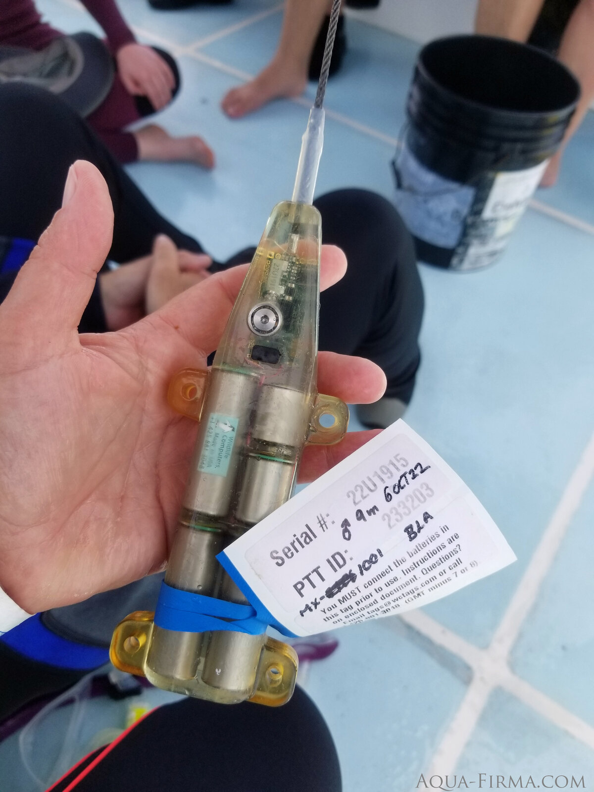
How long a satellite tag can gather and transmit data depends upon how much you draw on its limited battery supply. Simple positional data does not draw a heavy load, so a tag can provide bursts of tracking data for 2 years or more. If you want to gather detailed movement information, tracking depth, speed and rotational movement, then a battery might only last for 2 weeks. These tags, with the greatest computing power, have to be physically recovered from the shark in order to secure the data.
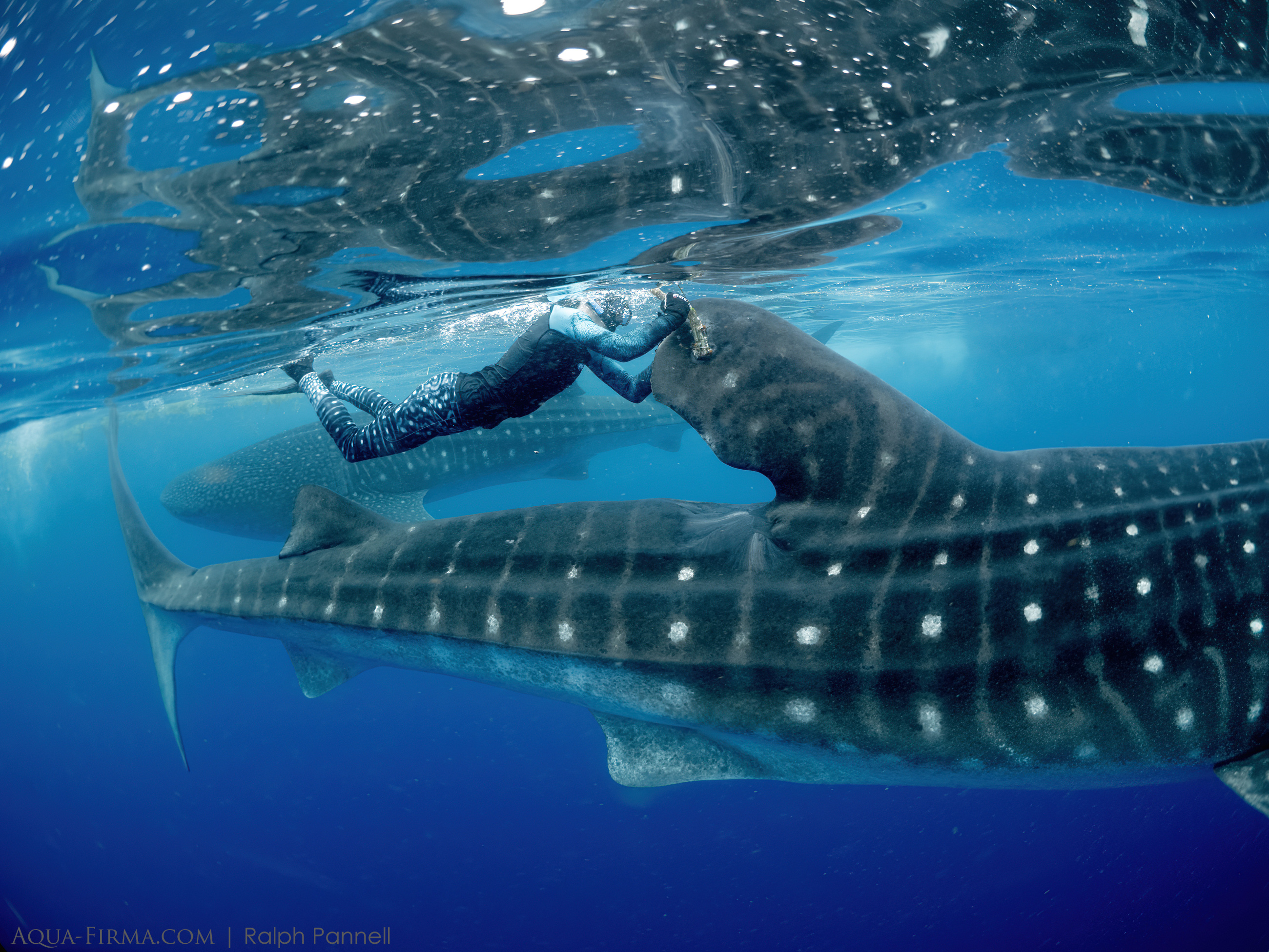
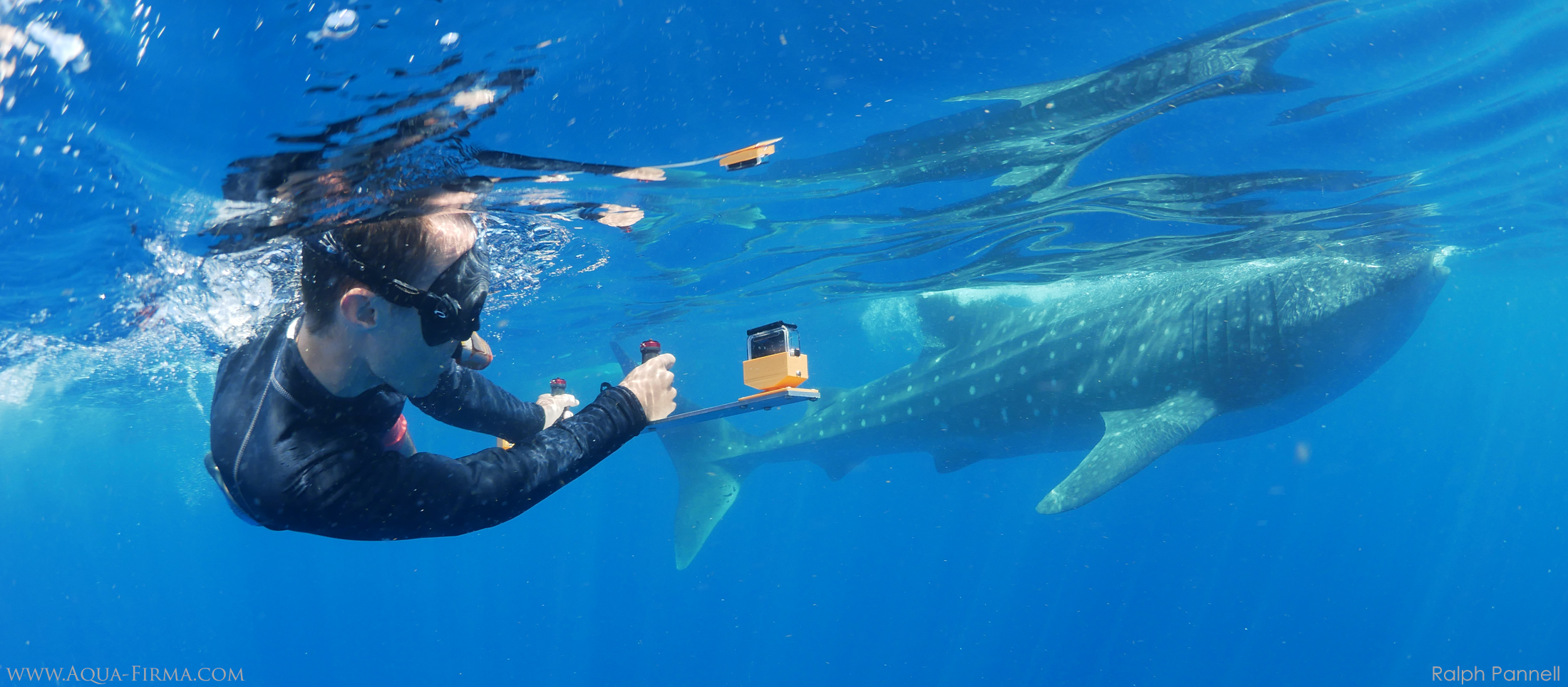
A secondary issue with tag performance is barnacle growth. Whilst a battery might last more than 2 years, barnacles can build up and interrupt its function sooner than that. In these photos MMF researcher, Dr Clare Prebble, managed to clear barnacles on a tag attached to a whale shark in Mexico. The shark fed and behaved as if Clare wasn't there; and within a few minutes the tag was back to full function.
Another type of tag employed at sites where we operate Whale Shark Research trips, is an acoustic 'pinger' tag. These are much cheaper devices and work by emitting ultrasonic bursts with a range of about 300 metres. When a shark carries one of these tags close to an array of radio receivers, the shark can be recognised. Our partners at the Marine Megafauna Foundation has installed one of these systems in Tanzania. This revealed that whale sharks, previously thought to visit the area seasonally, were in fact resident year-round. It turns out that they spend most of their time feeding at depth, out of site. Their emergence at the surface coincides with seasonal wind driven upwellings which lifts their main food, a type of shrimp, to the surface.
Stella Diamant is Madagascar's leading whale shark scientist and host on our Whale Shark Research - Islands, Marine Life & Lemurs expeditions to the country. Aqua-Firma's trips to Madagascar helped fund Stella to establish a Tanzania-styled array of acoustic receivers In 2022. One of the purposes of this is to determine where whale sharks concentrate during their seasonal aggregations. We are fairly sure that existing protected areas do not cover all of the most important feeding grounds. Acoustic tag data will help Stella to guide local authorities to adjust the position and extent of Madagascar's most important marine reserve for whale sharks.
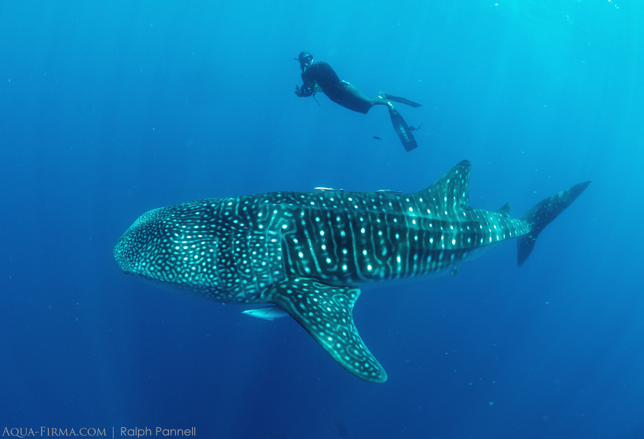
Here are some images from Mexico, Madagascar, Tanzania and Galapagos, showing our research hosts in tagging action. To learn how you can join one of our teams around the world, visit our Ocean Giant Expeditions web page.
Dr Clare Prebble clearing barnacles from a satellite tag in Mexico on AQUA-FIRMA Whale Shark Research & Photography trip. You can next join Clare & Marine Scientist, Charlotte Caffrey, in Mexico in July 2024.
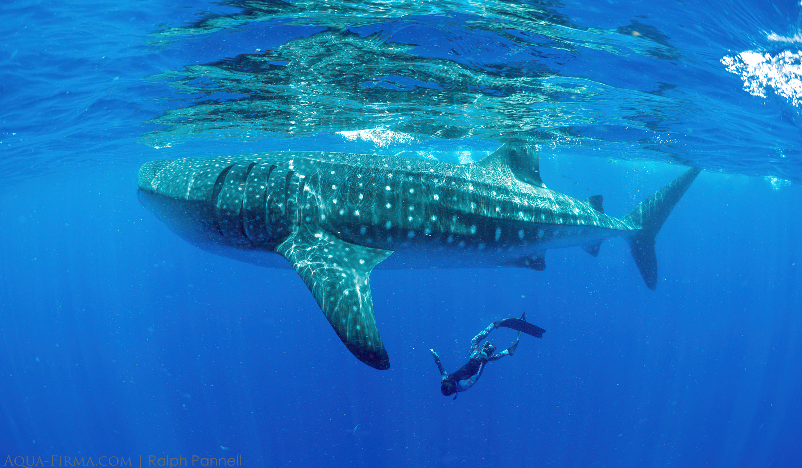
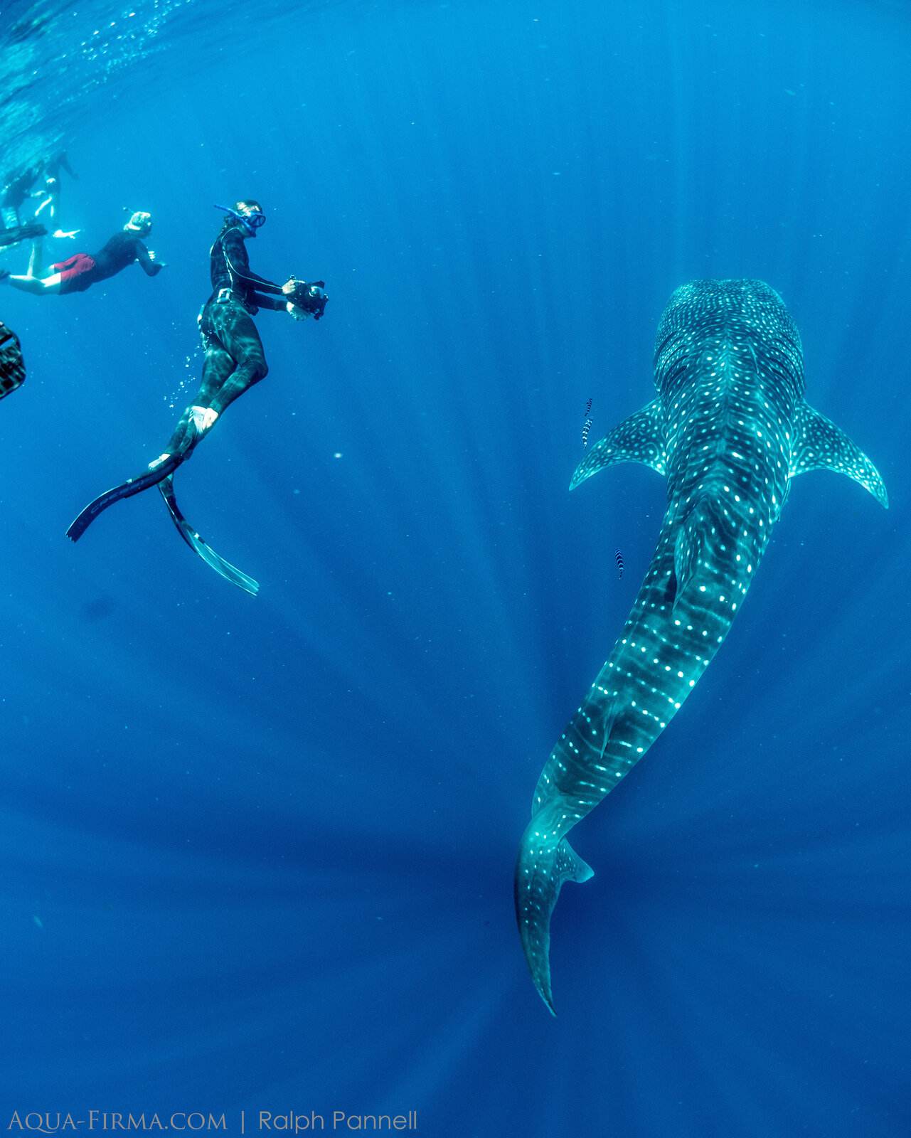
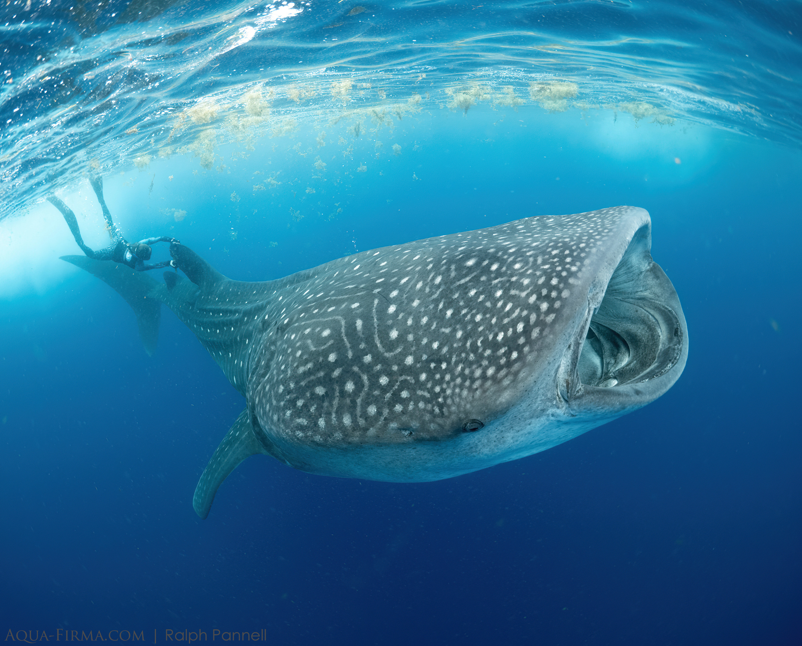
Checking the gender of a tagged whale shark on one of our Mexico Whale Shark Research & Photography trips.
The most widespread form of whale shark monitoring is through photo identification using whale shark's pattern of spots around gills on the left side of the fish. These spot patterns are unique to each shark, like a fingerprint, picked out from a digital image by NASA star-spotting software adapted to whale sharks. When a whale shark is spotted and photographed, researchers also take note of location, time and date, adding this to the global ECOCEAN database where all the data is held. If time permits, we try to check gender, take note of any marks and take a photo of the right-hand gill area as well - just as we are doing here in Madagascar:
Measuring a whale shark at the same time as IDing it is helpful for monitoring how an individual grows. How to measure a whale shark has evolved from using a log tape measure - a tricky operation with one tape holder swimming at the head and the other at the highly moveable tail end. Use of fixed lasers is the most common method, whilst a technique involving 3-D imagery was also tested on one of our Mexico Whale Shark Research & Photography trips by Dr Chris Rohner:
Photography by Ralph Pannell & Charlotte Caffrey